
Mount Juliet Neighbors by Record Type
Records about a Mount Juliet block are strongest when their purpose remains clear. A map establishes spatial relationship. An assessor card identifies an owner and parcel. A recorded plat explains the lot or common-area pattern. A community organization may publish public contacts, but not a member directory. Keep these evidence types in separate columns rather than blending them into a claim about who is present at an address.
| Source | What It Shows About a Block | Access |
|---|---|---|
| GIS parcel layer | Boundaries, parcel IDs, roads, address points, map relationship | Public city or county viewer |
| Assessor card | Owner, mailing address, lot or subdivision, transfer fields | TPAD or public terminal |
| Recorded plat | Lot and block layout, easements, common areas | WilsonDeeds, GIS, or Archives |
| Deed index | Recorded ownership history for a parcel | Account, scanned books, or Register request |
| Community contacts | Board, manager, documents, neighborhood names | Public organization material |
The statewide voter form requires details for one named person and does not offer a radius or nearby-voter tool. Its result should remain a narrow registration confirmation, not a block roster. For an entire named road, use the fuller address-record workflow in the Mount Juliet street directory.
GIS Lines Around Mount Juliet Neighbors
The Mt. Juliet GIS department links parcel and property viewers alongside address points, city limits, subdivisions, tax grids, annexation, zoning, flood, and urban-growth-boundary maps. Begin by locating the subject address. Zoom until the parcel edges and road frontage are clear, then identify only parcels that share a boundary, a defined frontage, or a recorded common-area relationship.
The exact adjacent-click, buffer, and measure controls in the dynamic viewer were not verified in the research. If a map does not open an owner detail, copy the parcel ID, complete address, lot and subdivision, or map-grid reference into TPAD. This preserves a reproducible path without claiming a button or result field that was not documented.
Note: A ZIP, school district, or subdivision can describe an area, but none alone establishes that two parcels touch.
Mount Juliet Neighbor Parcel Checks
TPAD is the second step after the map. The statewide property search accepts owner name, property address, subdivision, classification, sale date, and parcel components. Its property-address field allows a street number to be omitted, which helps when a map, old deed, and current mailing label use slightly different forms. Wilson County says its web-viewable assessor data is updated weekly and covers about 53,000 parcel cards.
- Record the exact subject address and map date.
- Identify the shared-boundary or frontage parcels in the viewer.
- Search each parcel separately in TPAD and preserve the parcel ID, owner, mailing address, lot, and transfer clue.
- Open the transfer reference in WilsonDeeds if recorded ownership history is needed.
- Mark map-only results separately from assessor-confirmed owner records.
An owner mailing address may be different from the situs address. It can reflect tax correspondence, a trust, estate, or other record condition, but it does not identify unnamed people connected to the parcel. Corner parcels should be recorded once, even if two roads touch the lot.
Providence's Public Community Layer
Community sources add neighborhood context rather than residence proof. The Providence of Mt Juliet publicly identifies sections including The Cottages, The Village, Bradford Park, The Reserve, Arbor Springs, Gas Lamps, Legacy Park, Autumn Ridge, Sterling Woods, Bridgemill, and Shadow Creek. It also lists a board, onsite manager, documents, and a Neighborhood Watch committee. Its restricted material is not a public member list.
| Public contact | What it can help identify |
|---|---|
| Providence of Mt Juliet, 555 Providence Trail, Mt. Juliet, TN 37122 | Community sections, public documents, and management contact. |
| 615-773-0745 | Published organization contact for questions about public material. |
| Mt. Juliet Police Neighborhood Watch guidance | How volunteers define a boundary and contact community policing, not a roster. |
City land-use material describes an HOA as a private relationship governed by recorded restrictive covenants. A community name can help find a recorded plat, but it cannot establish common membership or a household list.
Mount Juliet Neighbor Voter Limits
Tennessee's voter registration lookup is deliberately narrow. It asks for county, first name, last name, birth month, and birth year, then returns registration information or a no-record message. It has no public all-voters-by-address, street, radius, or block mode. Enter a known person's name exactly as shown on the registration card and contact the Wilson County Election Commission if a valid match needs clarification.
Wilson County offers digital voter lists by precinct, municipality, school district, county, and legislative district, but it describes those files as political-use only under T.C.A. § 2-2-138. Social Security numbers are redacted, and the request process does not require a new record compilation. Never build a list of Mount Juliet neighbors from isolated voter results.
Registry Search Is Not a Neighbor List
The Tennessee Felony Offender Information search is assigned to the local public-safety record landscape, but it is not evidence of a current neighborhood or household. It searches by name, TDOC ID, or State ID and has optional aliases and race fields. A result can show custody or status information that may have no connection to the nearby block.
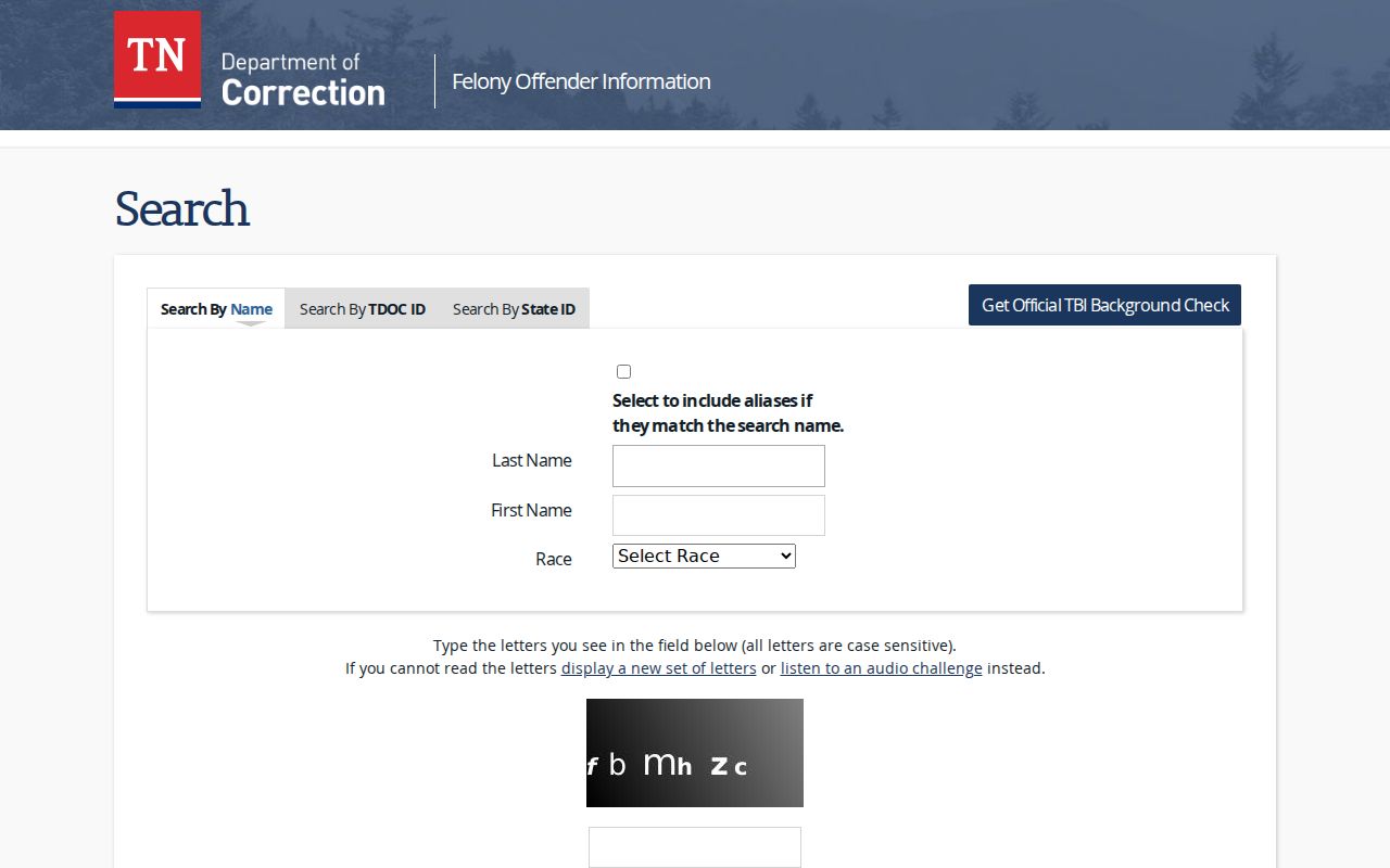
The search interface reinforces the difference between a state custody record and parcel adjacency. For a local incident report, the Mount Juliet Police Records and Court Unit is the appropriate custodian; for local jail material, no verified public Wilson County roster URL was located, so use the sheriff or Tennessee Public Records Act route.
Mount Juliet Block Plats and Deeds
After TPAD identifies a neighboring parcel, WilsonDeeds supplies the recorded-property layer. Use the assessor transfer reference, a grantor or grantee name, the legal description, or book and page to locate the most recent instrument. The result should be recorded as a deed party or owner-history clue, not as proof that the named party is now on the block. Wilson County reports searchable deed index and image material from November 1984, back-scanned index books from April 1925, and image-only deed material reaching 1793.
Plats often solve an address mismatch. A lot, block, or subdivision name can bridge a modern street label to an older recorded description. WilsonDeeds notes that plat books P9 through P17 do not have an index database, so browse by book and page when an address search fails. The Wilson County Register of Deeds search, the parcel map, and Wilson Archives provide three different routes when a deed or plat is not found in the first screen.
Keep the legal description, lot or subdivision, parcel ID, and map date together. A common subdivision name may point to a plat, but it does not prove that two people are related, share an organization, or appear in the same household.
Mapping a Mount Juliet Block
Define the block first, then connect records in order. The city and county map layers can resolve whether the parcel is in Mount Juliet city limits, unincorporated Wilson County, or near a postal boundary. A plat can carry the lot and subdivision through an address change. The Register's deed index documents recorded transfers, but a current street address may not appear in an older instrument.
Use a simple evidence flow: address to parcel map, parcel ID to assessor card, transfer reference to deed, lot and subdivision to plat, then city or county records for a dated permit or code file. Preserve the map date and municipal status. That route avoids a common myth that a commercial neighbor tool can replace records that explain what its result means.
Wilson County GIS can print an 8.5-by-11 map online; larger maps are available by request. Data layers are listed at $75 per layer. Those products provide geographic context, not an assurance that every person associated with a block is public.
Mount Juliet City Limits on a Block
Postal geography and municipal jurisdiction can differ on the same stretch of road. Mount Juliet GIS publishes city-limits, annexation, subdivision, tax-grid, and ZIP maps, while Wilson County maintains separate city-limit layers. Preserve both the parcel reference and the map date when a block touches a corporate boundary or older county record.
Official 2025 notices for properties on Nonaville Road, Old Lebanon Dirt Road, Lebanon Road, Benders Ferry Road, and Central Pike show why an annexation file can add useful timing to a parcel history. It can change the office that holds a planning or permit file, but it does not alter the recorded deed trail.
Mount Juliet Privacy Boundaries
Unlisted household members, utility accounts, delivery data, and motor-vehicle addresses are not ordinary public block records. Tennessee Safe at Home supplies qualifying participants with a substitute address, and sealed court or vital material remains protected. Private community portals and volunteer contact lists are also not public. A named owner, recorded party, permit applicant, and organization contact are different evidence types and should never be presented as the same thing.
Lawful use. Use Mount Juliet neighborhood records for personal, civic, family-history, and property-context research. Never use a result to monitor, stalk, harass, intimidate, or harm another person.